


LINWOOD - T 1 Voting District, Portage County, Wisconsin
About
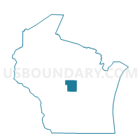
Outline

Summary
| Unique Area Identifier | 696295 |
| Name | LINWOOD - T 1 Voting District |
| County | Portage County |
| State | Wisconsin |
| Area (square miles) | 16.54 |
| Land Area (square miles) | 14.22 |
| Water Area (square miles) | 2.32 |
| % of Land Area | 85.96 |
| % of Water Area | 14.04 |
| Latitude of the Internal Point | 44.47894560 |
| Longtitude of the Internal Point | -89.62604250 |
Maps


Graphs
Select a template below for downloading or customizing gragh for LINWOOD - T 1 Voting District, Portage County, Wisconsin


Neighbors
Neighoring Voting District (by Name) Neighboring Voting District on the Map
- Biron - V 1 Voting District, Wood County, WI
- CARSON - T 2 Voting District, Portage County, WI
- LINWOOD - T 2 Voting District, Portage County, WI
- PLOVER - T 4 Voting District, Portage County, WI
- Plover - V 4 Voting District, Portage County, WI
- RUDOLPH - T 1 Voting District, Wood County, WI
- Stevens Point - C 17 Voting District, Portage County, WI
- Whiting - V 4 Voting District, Portage County, WI
Top 10 Neighboring County Subdivision (by Population) Neighboring County Subdivision on the Map
- Stevens Point city, Portage County, WI (26,717)
- Plover village, Portage County, WI (12,123)
- Whiting village, Portage County, WI (1,724)
- Plover town, Portage County, WI (1,701)
- Carson town, Portage County, WI (1,305)
- Linwood town, Portage County, WI (1,121)
- Rudolph town, Wood County, WI (1,028)
- Biron village, Wood County, WI (839)
Top 10 Neighboring Place (by Population) Neighboring Place on the Map
- Stevens Point city, WI (26,717)
- Plover village, WI (12,123)
- Whiting village, WI (1,724)
- Biron village, WI (839)
Top 10 Neighboring Unified School District (by Population) Neighboring Unified School District on the Map
Top 10 Neighboring State Legislative District Lower Chamber (by Population) Neighboring State Legislative District Lower Chamber on the Map
- Assembly District 71, WI (57,415)
- Assembly District 72, WI (55,757)
- Assembly District 70, WI (53,911)
Top 10 Neighboring State Legislative District Upper Chamber (by Population) Neighboring State Legislative District Upper Chamber on the Map
Top 10 Neighboring 111th Congressional District (by Population) Neighboring 111th Congressional District on the Map
Top 10 Neighboring Census Tract (by Population) Neighboring Census Tract on the Map
- Census Tract 9611, Portage County, WI (6,321)
- Census Tract 9612, Portage County, WI (6,036)
- Census Tract 110, Wood County, WI (5,695)
- Census Tract 9602, Portage County, WI (4,540)
- Census Tract 111, Wood County, WI (3,523)